RouteWatch®
Woods Hole Group offers an integrated routing and weather forecasting
package in support of ocean-going vessels. RouteWatch®, is a comprehensive,
multi-faceted product designed to increase transit efficiency, provide
situational awareness, and mitigate risk during vessel/asset relocation
projects. Increased transit efficiencies through either time or fuel savings are
accomplished by helping vessels harness favorable ocean currents and avoid
opposing flow.
In the event of a storm, we
provide alternate routing strategies to both lessen the effects of winds/waves and
manage the time penalty incurred by steering off track. All reports are assembled
by experienced oceanographers/routing analysts and include a concise,
informative narrative describing parameters considered, potential advantages/disadvantages
of certain routes, and the expected metocean conditions along each.
The
RouteWatch® service is unique in that each routing report can be tailored to
the specific needs and requirements of the captain.
Voyage Optimization
- Robust and
highly-flexible numerical integration routine that involves calculation of set
and drift along track, based on spatially and temporally interpolated current
values.
- A proprietary method
utilizing HYCOM + NCODA reanalysis data is used to augment available forecast data
to more accurately quantify time savings/loss for long-term and large-scale
route alterations.
The Reports
- Routing reports are submitted tri-weekly, while weather
forecasts are submitted twice per day when underway. Reports are emailed in a
low-bandwidth PDF format and are also made available through our online
MetOcean Mapper portal.
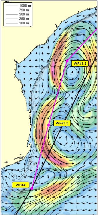
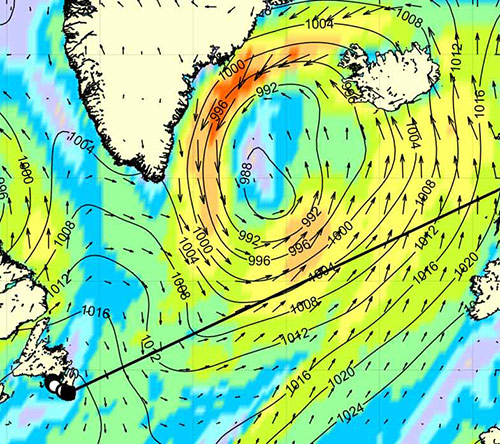
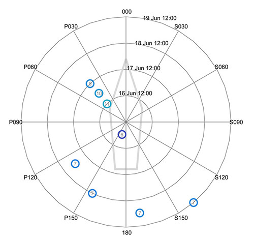
- Reports include high-quality and easy to understand
color-enhanced maps and graphics that allow the captain to contextualize data
from a multiplicity of data sources and enable quick comparison of different
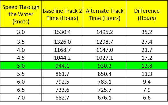
routes. Reports are also fitted with an expected time of arrival and time
savings table calculated for various speeds through the water.
- A large number of variables are considered in each routing
update depending on the region, vessel type, and specific requirements/concerns
conveyed by the captain.
- Waypoints for recommend
routes are provided in an easily importable file format to be passed to the
onboard ECDIS system to confirm that the track is navigationally safe.
The MetOcean Mapper
- The Mapper is an interactive,
password-protected portal accessible by internet connection. A low-bandwidth
version of the Mapper is available for users with limited connectivity.
- A standalone
GPS beacon is provided to the vessel and
programmed to transmit one position per hour through the Iridium network of
satellites. The vessel’s position is displayed as a ship icon along with the vessel’s
present and recommended track.
- Standard metocean layers include colorized Global Forecast
System winds (GFS), Global Ensemble Ocean Wave Forecast System (GEOWaFS),
HYbrid Coordinate Ocean Model (HYCOM), and Real Time Ocean Forecast System
(RTOFS). Additionally, we work in tandem with a team of meteorologists to
display active tropical storm tracks, enhanced global infrared imagery, and lightning
strikes. All layers update at regular intervals throughout the day.
- Navigationally pertinent datasets available on the Mapper
include GEBCO bathymetry (global 30 arc-second interval grid), lease areas and
blocks, pipelines/platforms, traffic separation schemes, piracy exclusion
zones, exclusive economic zones, and NOAA nautical charts.
Pre-Voyage Route Reviews/Planning
- Comprehensive pre-departure route analysis and routing recommendations
are available as a separate product and serve as an excellent route planning
tool.
- Reports are founded on the experience of our routing analysts, various
metocean climatologies, and concerns/requirements communicated by the captain.
